
Context
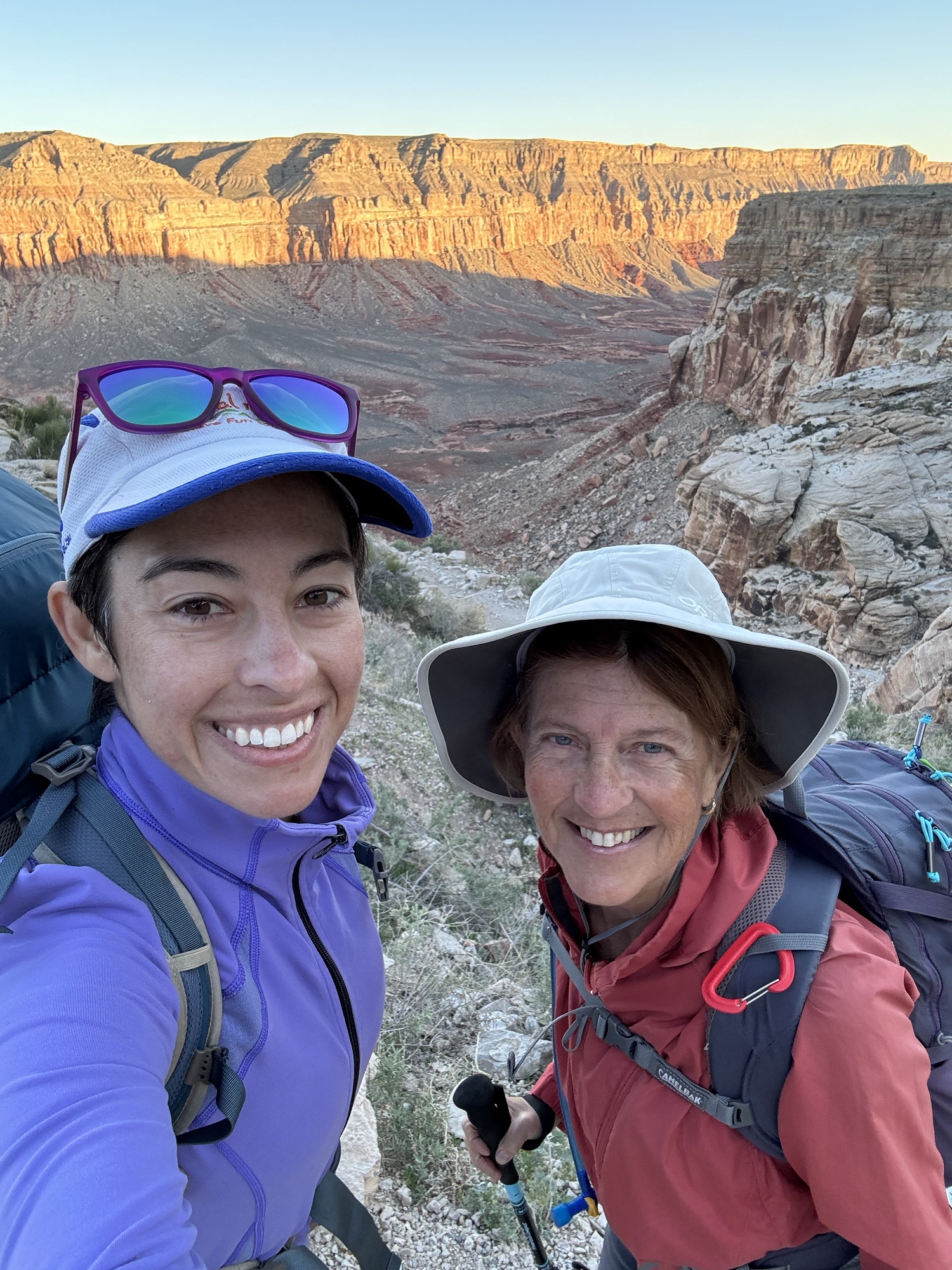
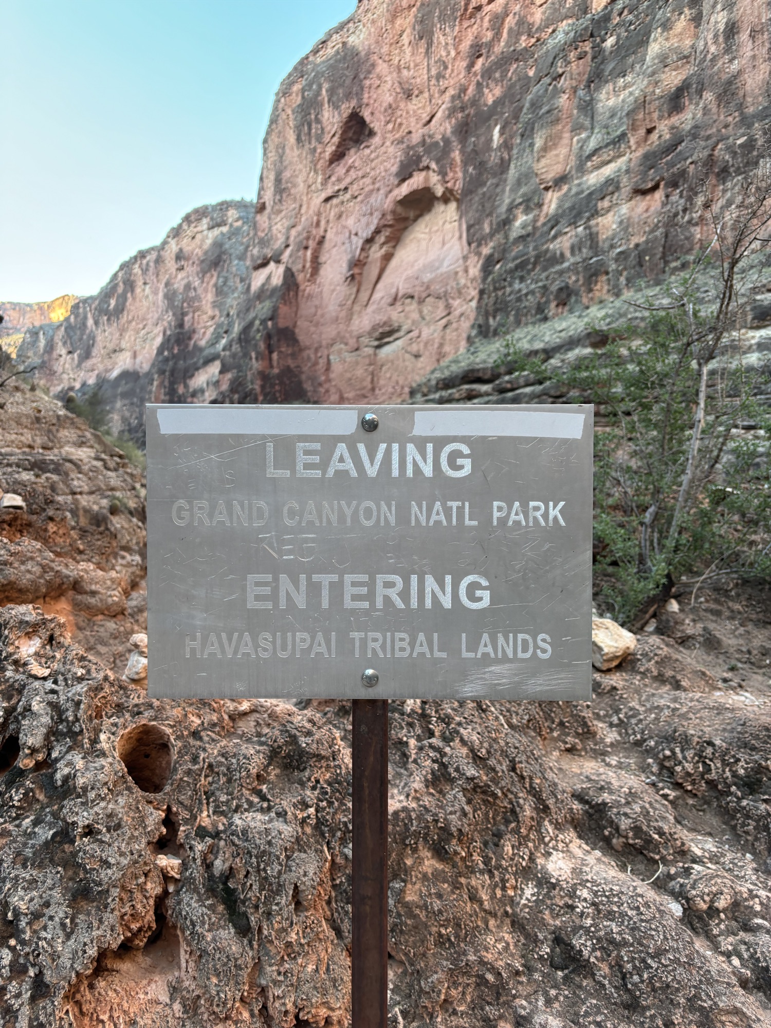
Last week, Mom and I went to Havasu Canyon, which is a canyon in Arizona along the Havasu Creek that feeds into the Grand Canyon. The Havasupai people are an American Indian people & tribe who have lived there for almost 1,000 years, and the land is owned by them; they open it up to tourists/visitors at certain times of year for hiking and exploring.
Mom and I spent three days in the canyon, and it is absolutely beautiful. While this weekend wasn’t actually a race, I wanted to share some thoughts on it here, since there are a lot of folks who do a lot of research before heading down and it seems like this could be helpful for those people. Also, it was an amazing adventure and I took lots of pictures.
The process to get a permit is quite challenging – Mom did all of this, for which I am very grateful. Permits are either for camping or staying at hte lodge. We stayed at the lodge. If you do this trip, definitely research the permitting situation before making plans.
Day 1
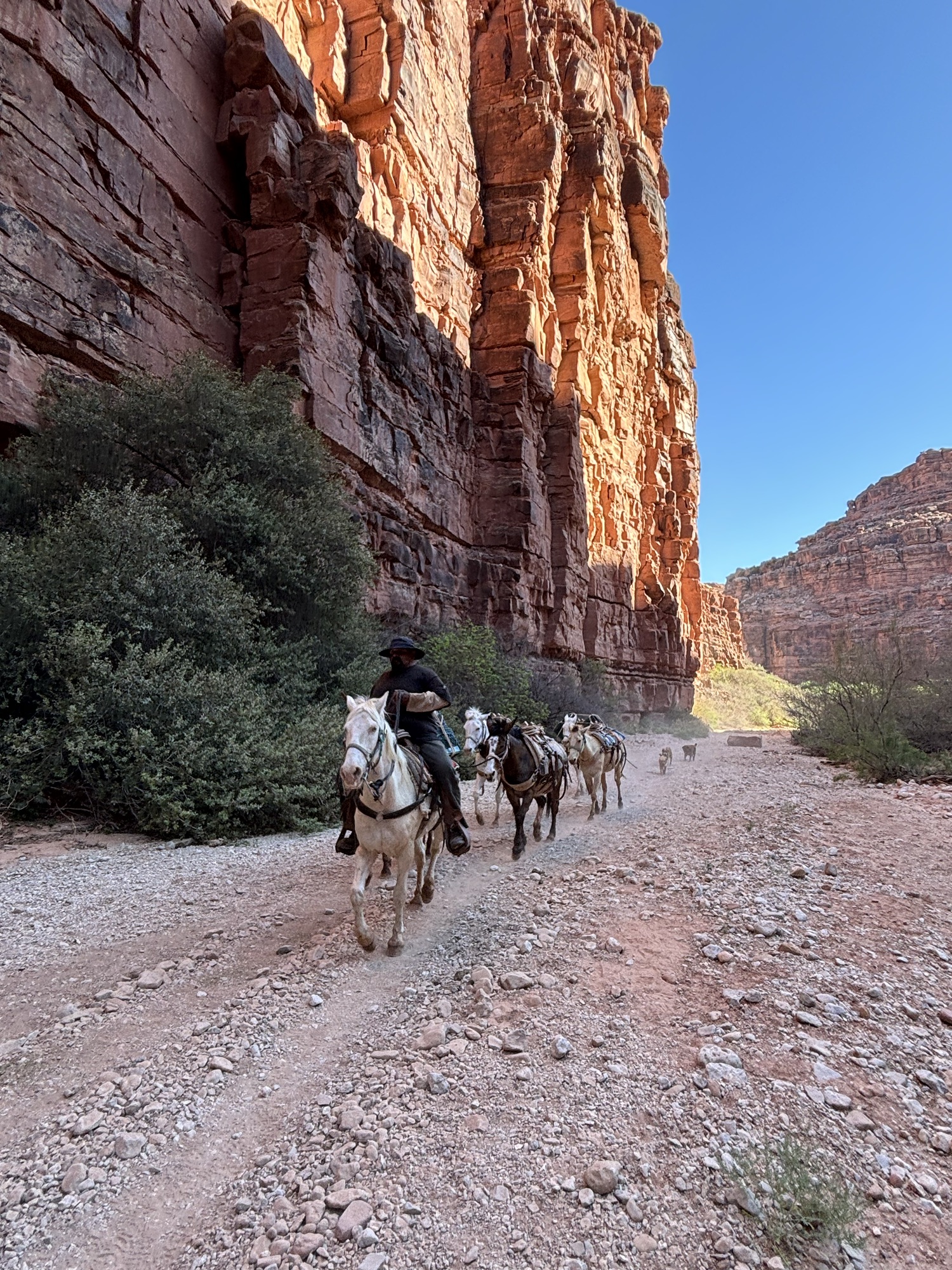
On Day 1 of our hike, we started at the top of the rim (“Hilltop”) and headed down to Supai, the small town in the canyon. The hike from Hilltop to Supai is about 8 miles, and it’s pretty easy downhill, with the majority of the descent happening in the first mile. The views were incredible – I couldn’t stop taking photos of the red colors and incredible formations. We saw some hikers returning up, and a number of mule trains that were bringing up hiker gear and mail. It’s impossible to get lost, because you are in a canyon and there are no other trails / ways out of the canyon. When trail gets to the one decision-point, there are a large volume of signs pointing to the left, so it is well-marked at the one area where there may be confusion.
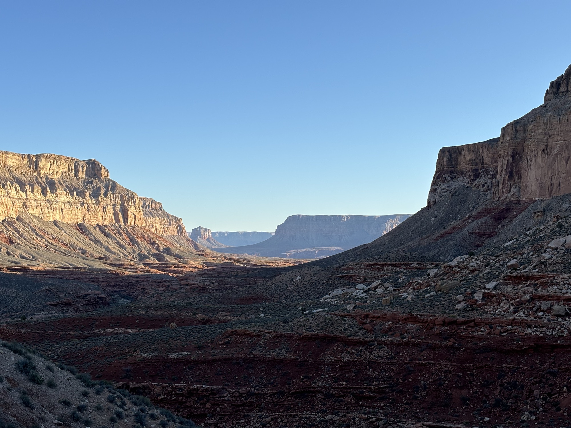
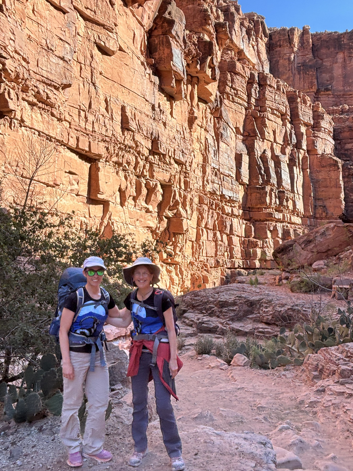
Once we got to Supai, we stopped by the Lodge. It was only about 10am, so they were not ready for us to check in. Our plan was to keep hiking down to see some of the waterfalls closer to the campsite, so we headed further into the canyon. The distance from Supai to the campsite is about 2 miles, so for those who are camping (most people) and not staying at the lodge, the first day would be about ten miles of downhill hiking from Hilltop to the campsite.
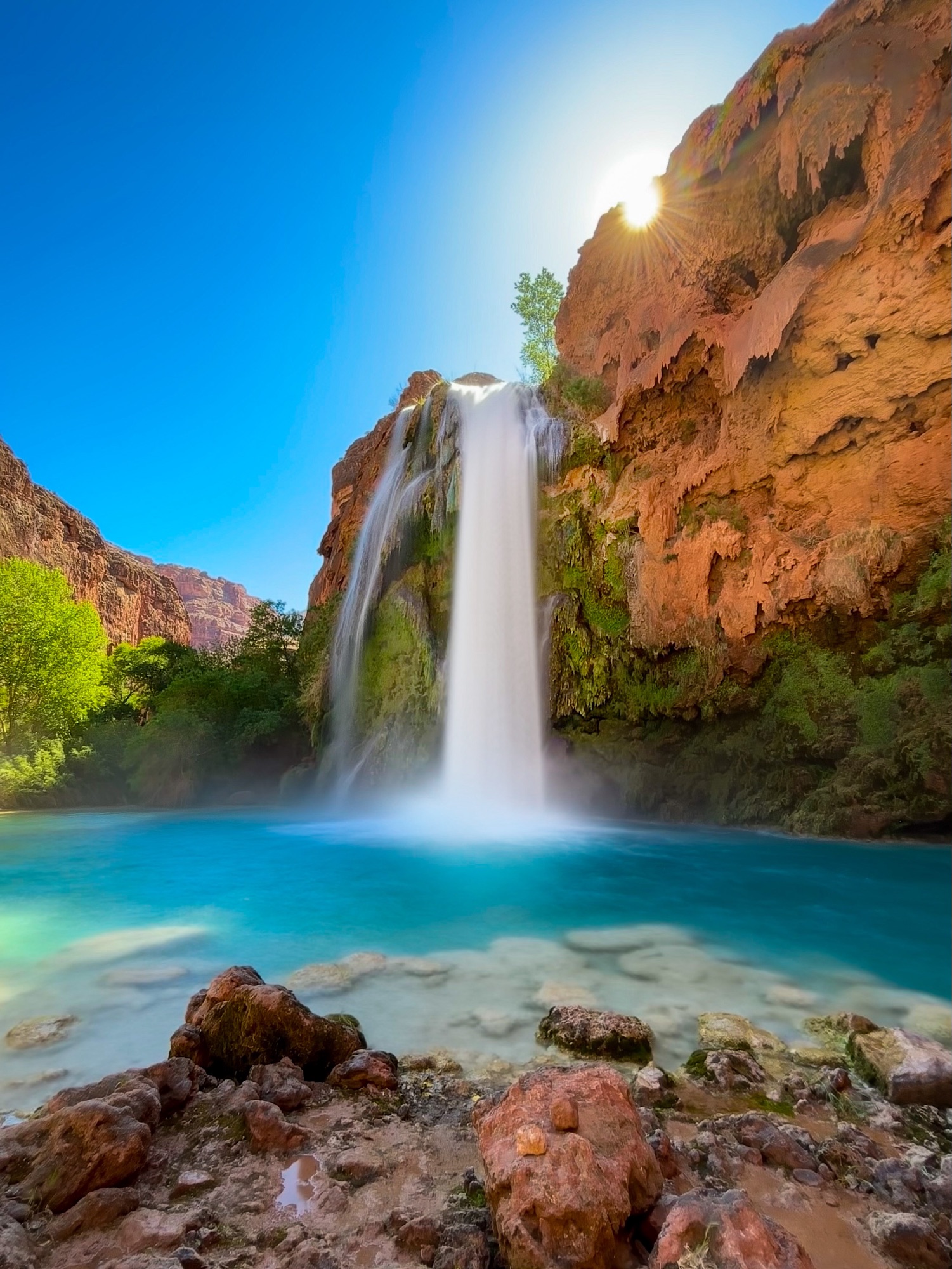
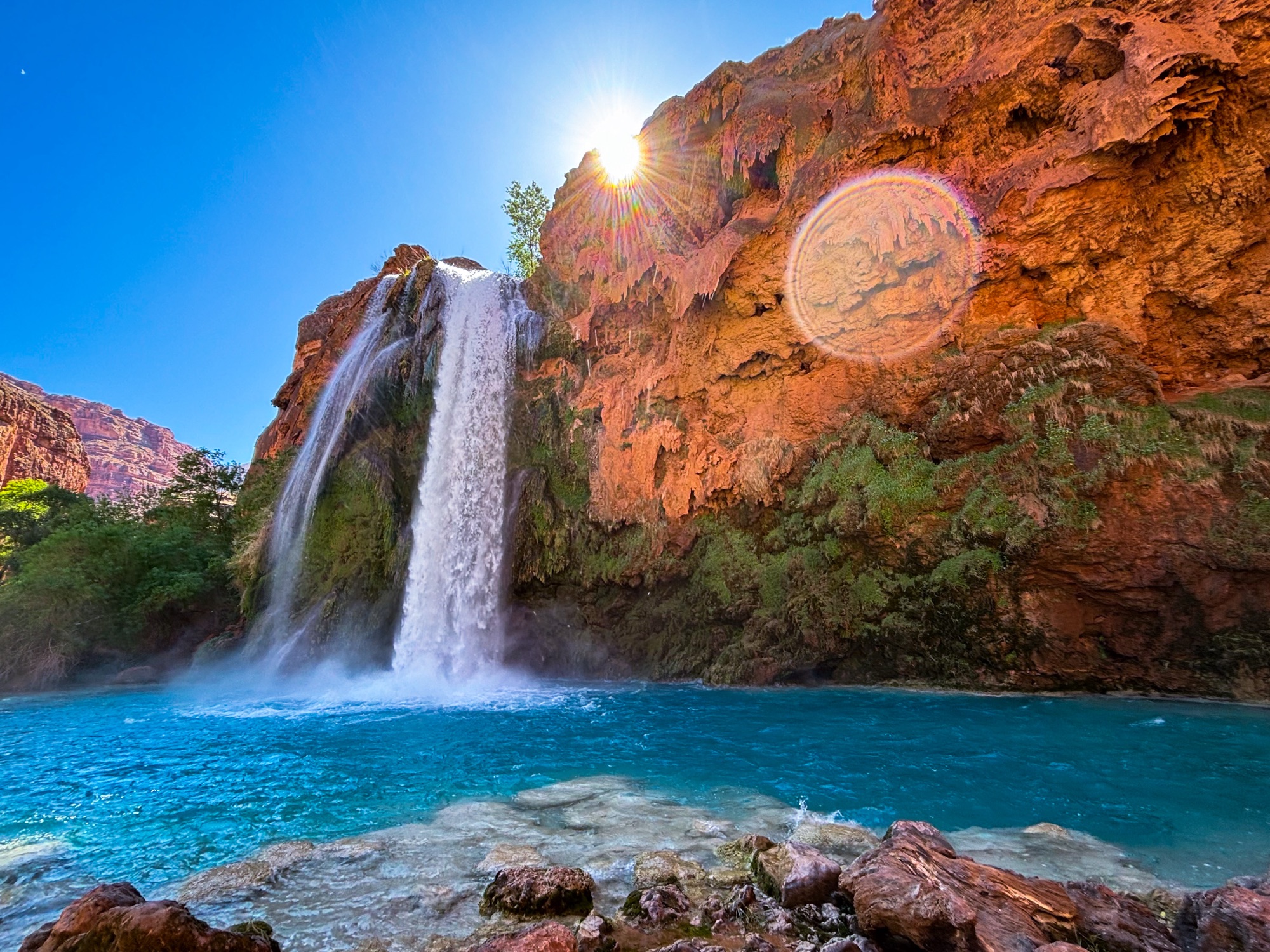
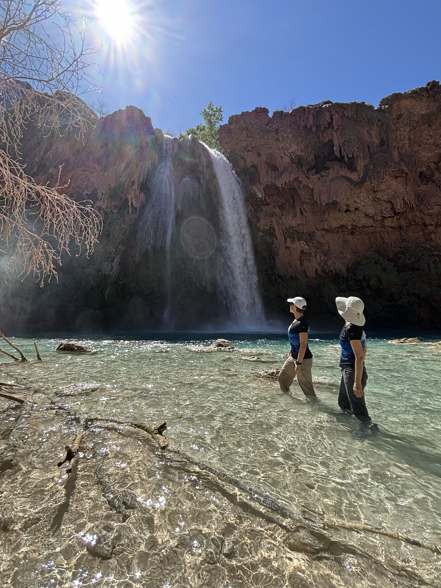
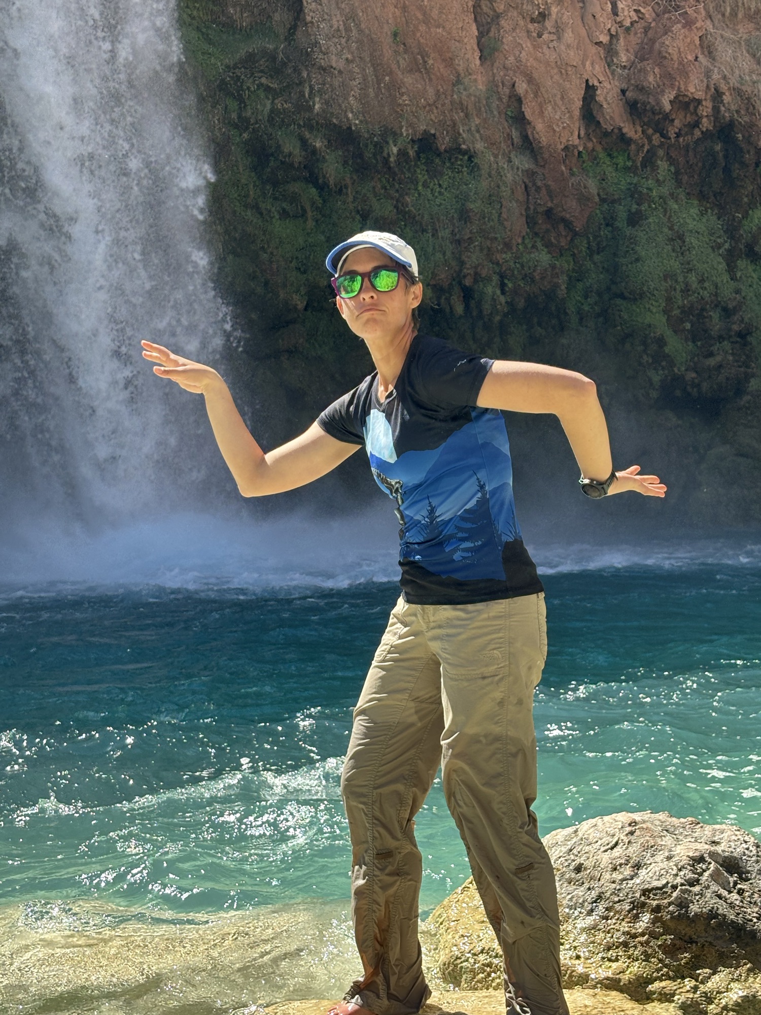
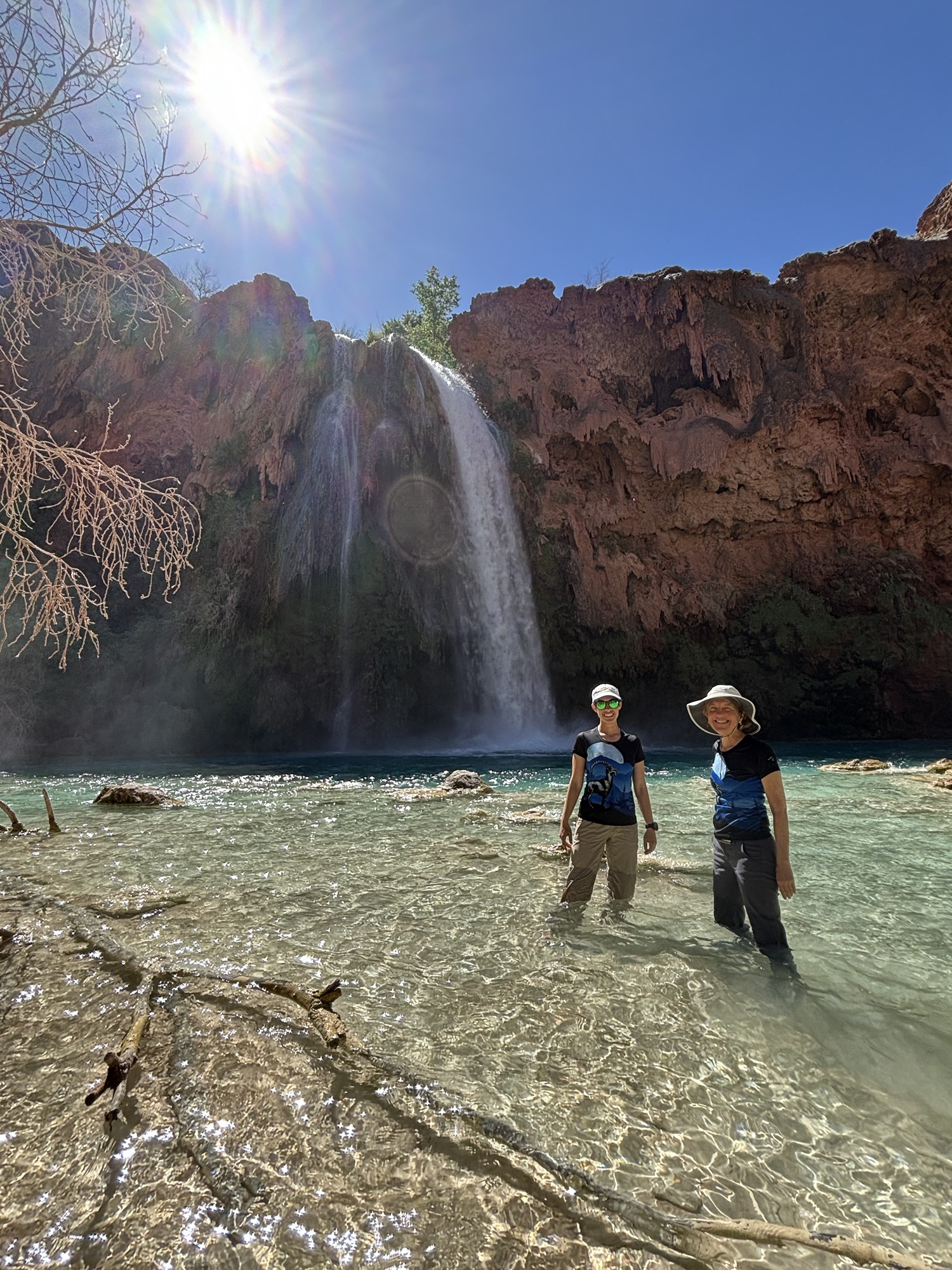
Havasu Falls (pictures below) are absolutely gorgeous. The colors are absolutely incredible in person – so vivid. Havasu means “blue-green waters” and pai means “people,” so Havasupai means “people of the blue-green waters.” The blue/green color comes from the lime that is in the water, which also creates many of the rock formations on the walls, and is the same element that creates cave formations. The contrast between that color and the red on the rocks was stunning.
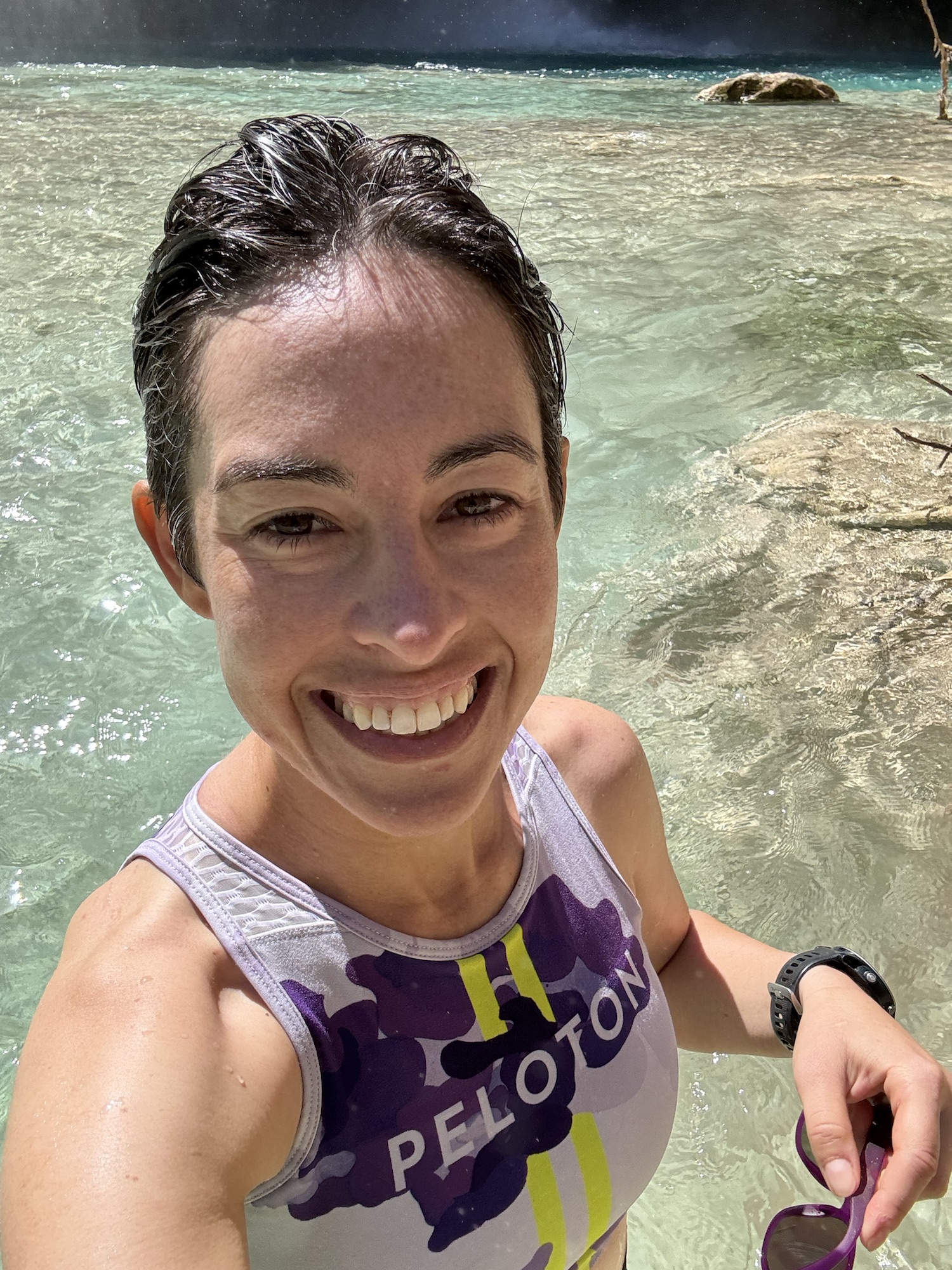
We spent some time there swimming around and playing in the water. The water wasn’t too cold – I think we got lucky with the weather, because any earlier in the year and the ambient air temperature would have been too cold and this would have been significantly less fun. Any later in the year and the water wouldn’t have been as strong.

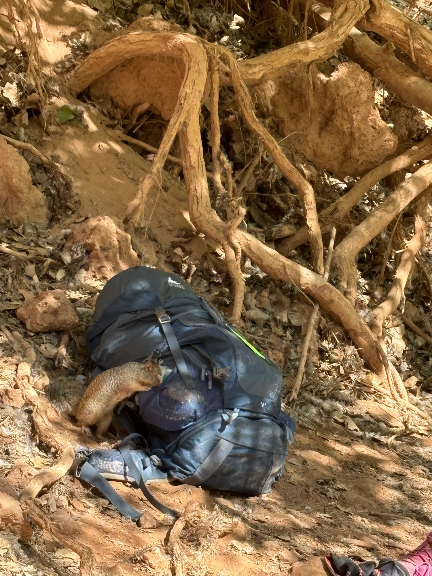
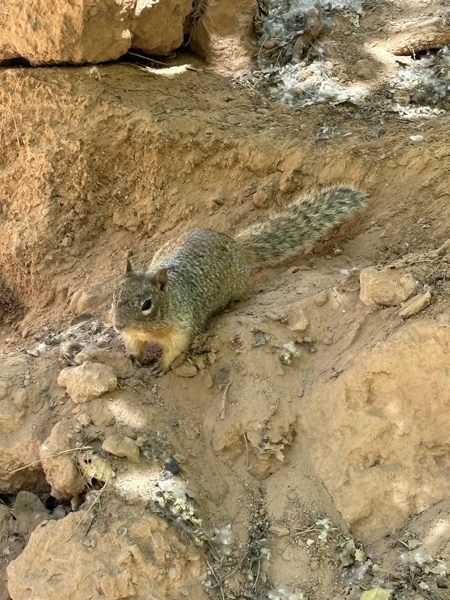
While I was in the water, I saw a kid walking over to my backpack – it turns out this squirrel had found some nuts in my bag, chewed through the plastic, and was having a bit of a feast. Here he is with his face in my backpack, then looking unrepentant after stealing some snacks. I thought I had secured all of my food effectively, but clearly not well enough!
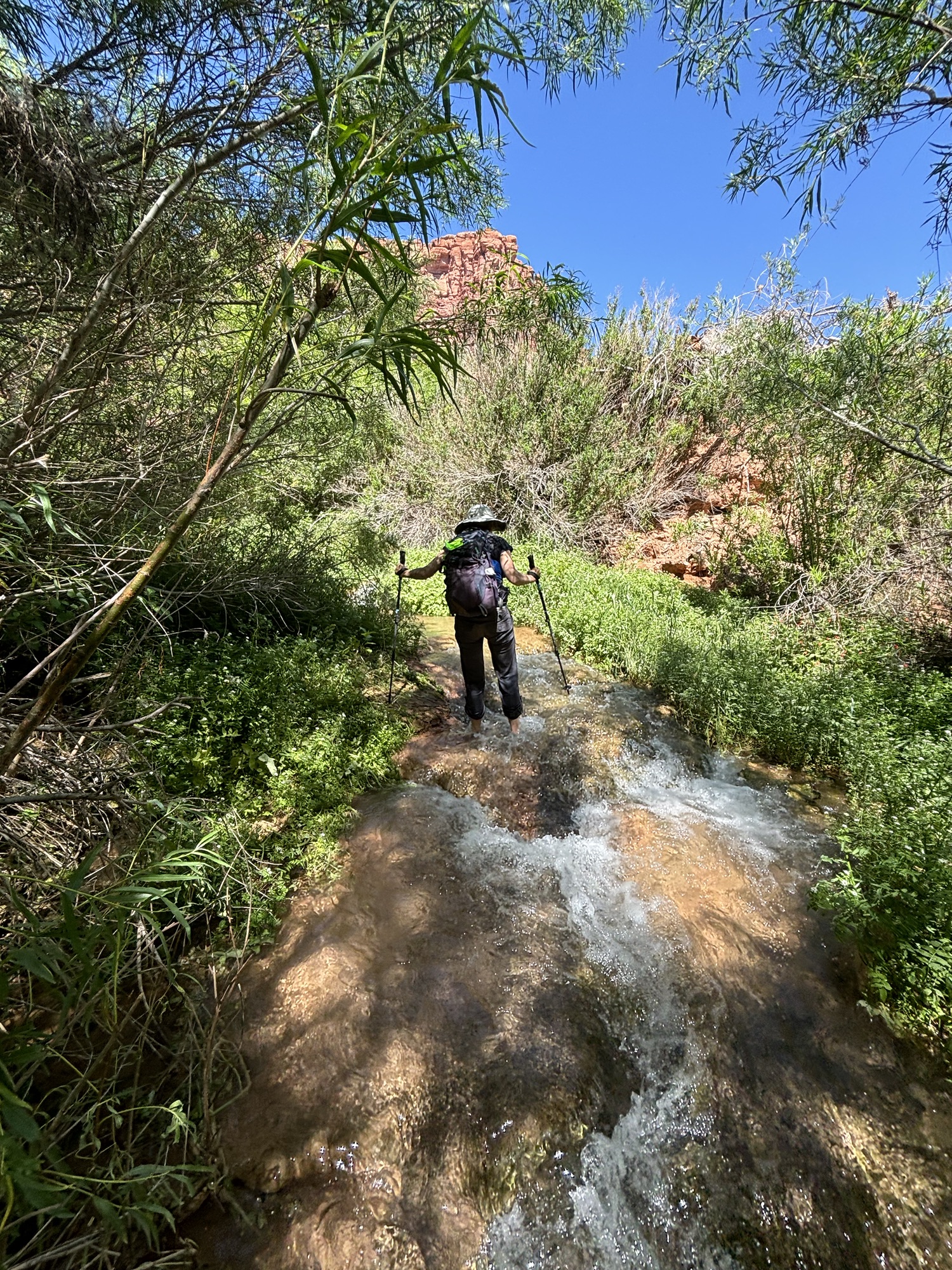
We visited the campsite briefly just to see it, then headed back up the canyon towards Supai. On the way back we visited 50 Foot Falls – pictured below – which required a bit of a hike up a river. You can see Mom hiking up the river in the first image. These were one of my favorite falls – I wish I had spent more time here, but was a bit worried about leaving my pack alone.
A quick note about shoes – this hiking experience has a large number of water crossings, so many people are curious what shoes will work best. I wore the Hoka Speedgoat 5 for this whole trip. They are trail running shoes that are very breathable. I wore them in the water and on the trail. I have never had problems doing water crossings a part of races with them in the past, and I didn’t on this trip. Day 2 had about 12-14 water crossings and I had no issues. Many people who visit Havasu Canyon will bring water shoes specifically for water crossings or getting into the water, but I didn’t do that and didn’t wish that I had. Mom brought water shoes and was happy with her choice, whereas I appreciated not having to change shoes at every water crossing. (Note – I am not affiliated with Hoka in any way – these shoes just work well for me and I like them).

When we returned to Supai, the Lodge was ready for us to check in. The Lodge was pretty nice – two queen beds, a comfortable amount of space to hang out in the room incl a couch and small table, a full shower/sink/bathroom, etc.
We headed back to Supai to the cafe there – there is only one cafe – and got lunch/ early dinner. It is the only game in town for hot food unless you bring a camping stove, so plan accordingly.
There isn’t a whole lot to do in Supai. In the afternoon, Mom and I did some reading, napping, and planning for the next day. Highly recommend bringing some activities to do with your group, like cards or boardgames, because in most cases you will have some downtime on most of the days.
This is what Day 1 looked like (Strava link).


Day 2
Our plan for Day 2 was to hike (Mom) / run (Me) further down the canyon, then meet up back in Supai for a late lunch. Mom wanted to make it to Beaver Falls (about 12-13 miles round trip), and I wanted to run to the Confluence where the Havasu Creek meets the Colorado River/Grand Canyon (about 20 miles round trip).
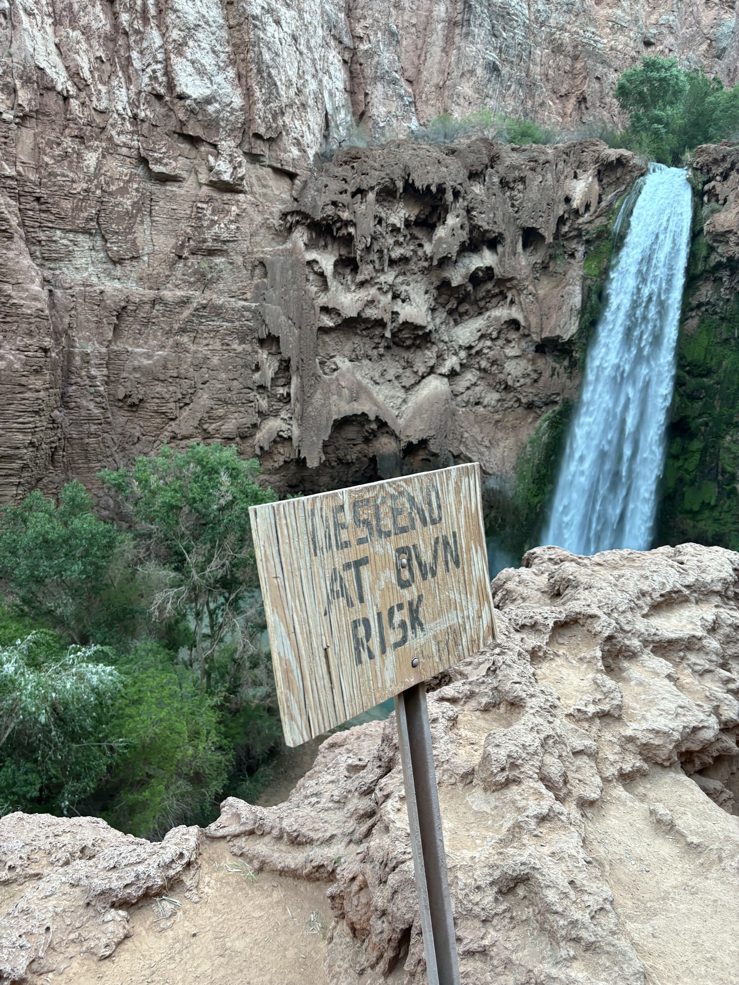
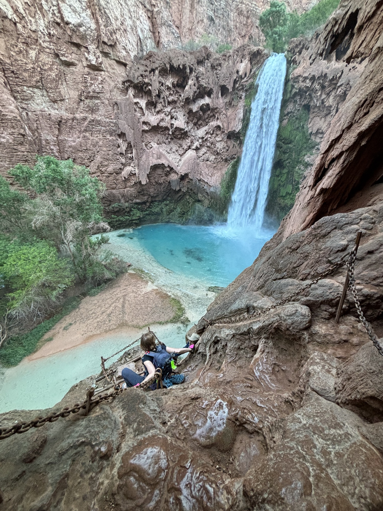
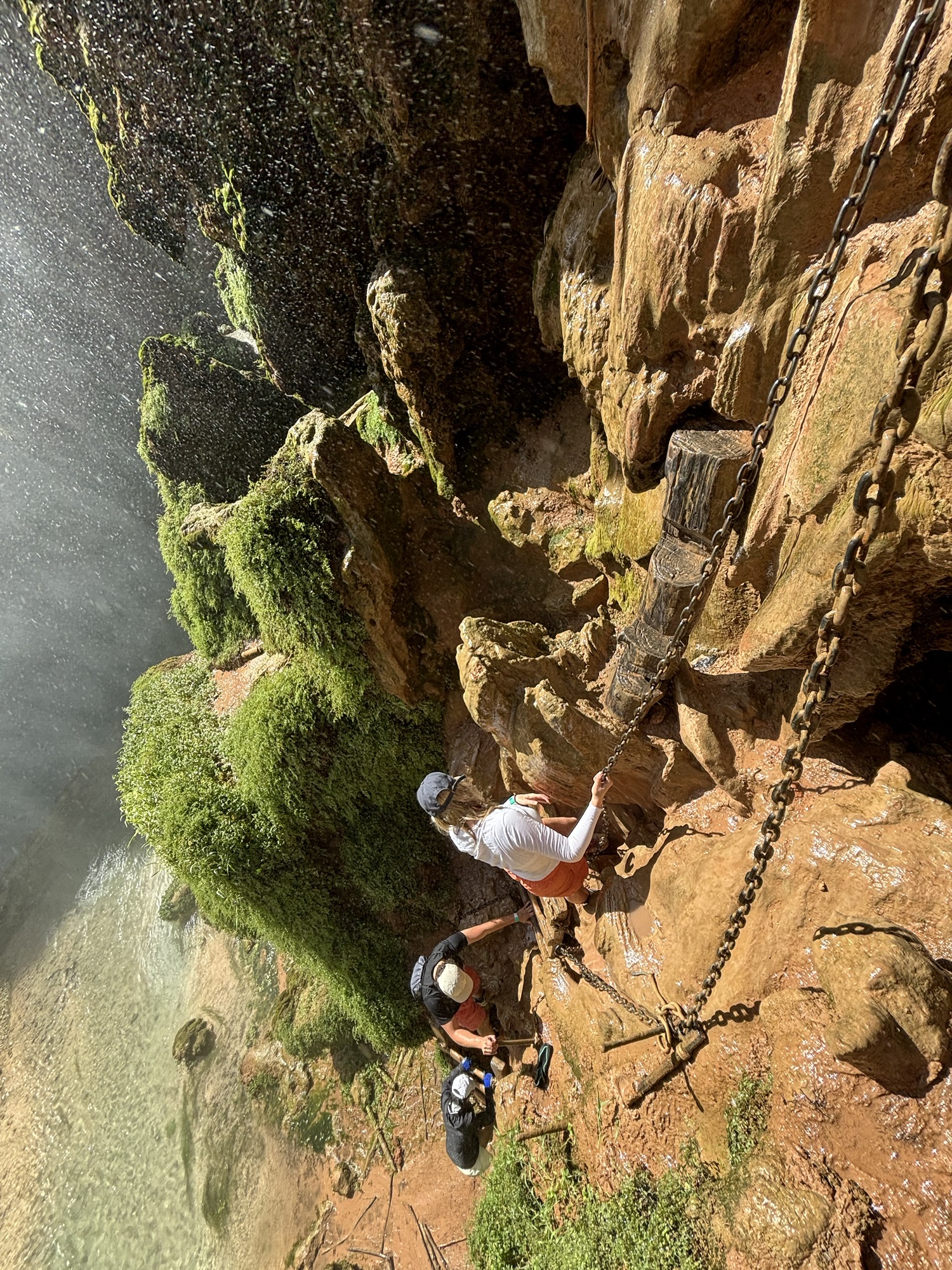
On the way to each of those is a somewhat precarious section right before Mooney Falls. This section is often referred to as The Chains. I affectionately renamed it the “Death Ladder.” This section is about 150-200 feet of a nearly vertical descent, with somewhat questionably maintained climbing aids. It is also located directly downwind of Mooney Falls themselves, so the chains, ladders, and rocks are very wet and slippery. My personal opinion is that this particular route down is probably not long for this world, because the descent is quite dangerous.
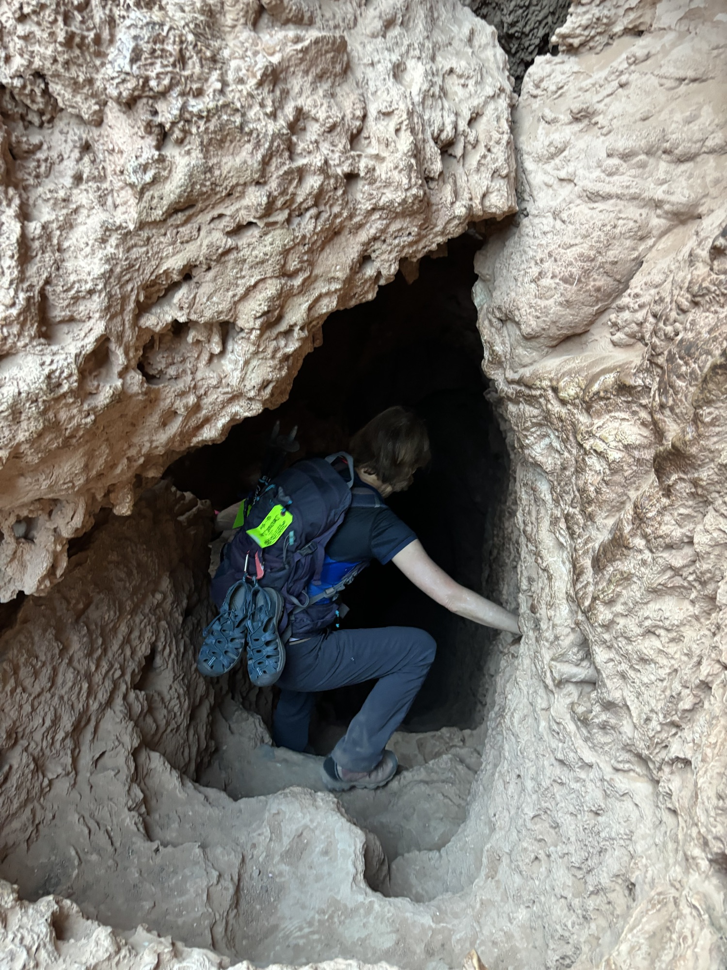
There are three parts to the descent:
- The cave: pretty easy. It is not dark and there are somewhat clear steps.
- The chains: absolutely terrifying. The rock here is quite slick and quite steep. There are very few obvious handholds or footholds. Based on my experience, there is basically exactly one way to get down – e.g. places where there is ONLY one place to put your foot, and that is what everyone is using. This is a situation in which you want to use the obvious (e.g. only) footholds and not do any sort of route innovation. The handholds are mostly the chains themselves, which are drilled into the rock and then tied into knots to create places that your hand can grip. There is one section here that is basically a small log with some hacked out footholds; the log seems to be held in place against the slick, wet rock via the force of friction and prayers, which doesn’t really inspire confidence. I was not nervous about the Death Ladder until I got to this specific section. We did make it down, and tons of people do it every day, but I am not at all sure this was safe. There are boxes of gloves at the top and bottom of this section that are free to use. Mom brought her own, and I didn’t think about it at all, so I chose not to use any gloves.
- The ladders: at the bottom of the descent there are two well-worn wooden ladders. Once I got to this section I felt a bit better about the whole thing.
Overall, this is not for the faint of heart. I saw some folks on the Death Ladder who probably should not have been taking on this challenge. I also saw some folks who were clearly rock climbers, and scrambled up and down like monkeys. Your mileage may vary, but I would proceed with caution here.
Fun fact: The waterfall was named for D.W. “James” Mooney who, in 1882, plummeted to his death over the side of the falls. So that should give you an idea of how precarious the Death Ladder is.
Once we got down, Mom and I were visibly relieved. After regaining some equilibrium, we split up; I took off running towards the confluence, and she started her hike down to Beaver Falls.
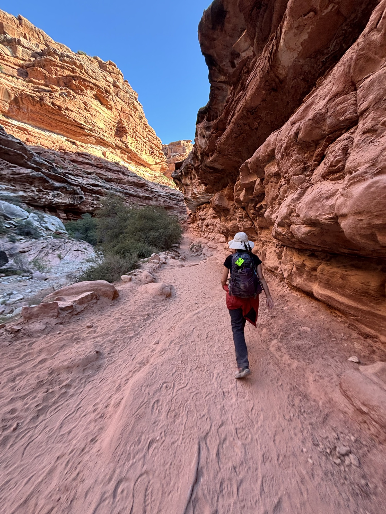
The next 7 miles to the Confluence were pretty great. There are a lot of river crossings, and the trail isn’t always excellently marked, but it’s one-way down a canyon so it is hard to get lost. My litmus test for whether or not I was on the right trail was “if this is hard for me, it’s probably the wrong way to go;” there were a few times I got confused and was literally bouldering on a canyon wall before realizing that there was zero chance I was on the right trail. A minute or two of backtracking solved the problem. There are also many other hikers that can jointly problem solve. I was the first one to the Confluence that day, but on the way back I saw a lot of folks who were able to help me when I got confused or off trail.
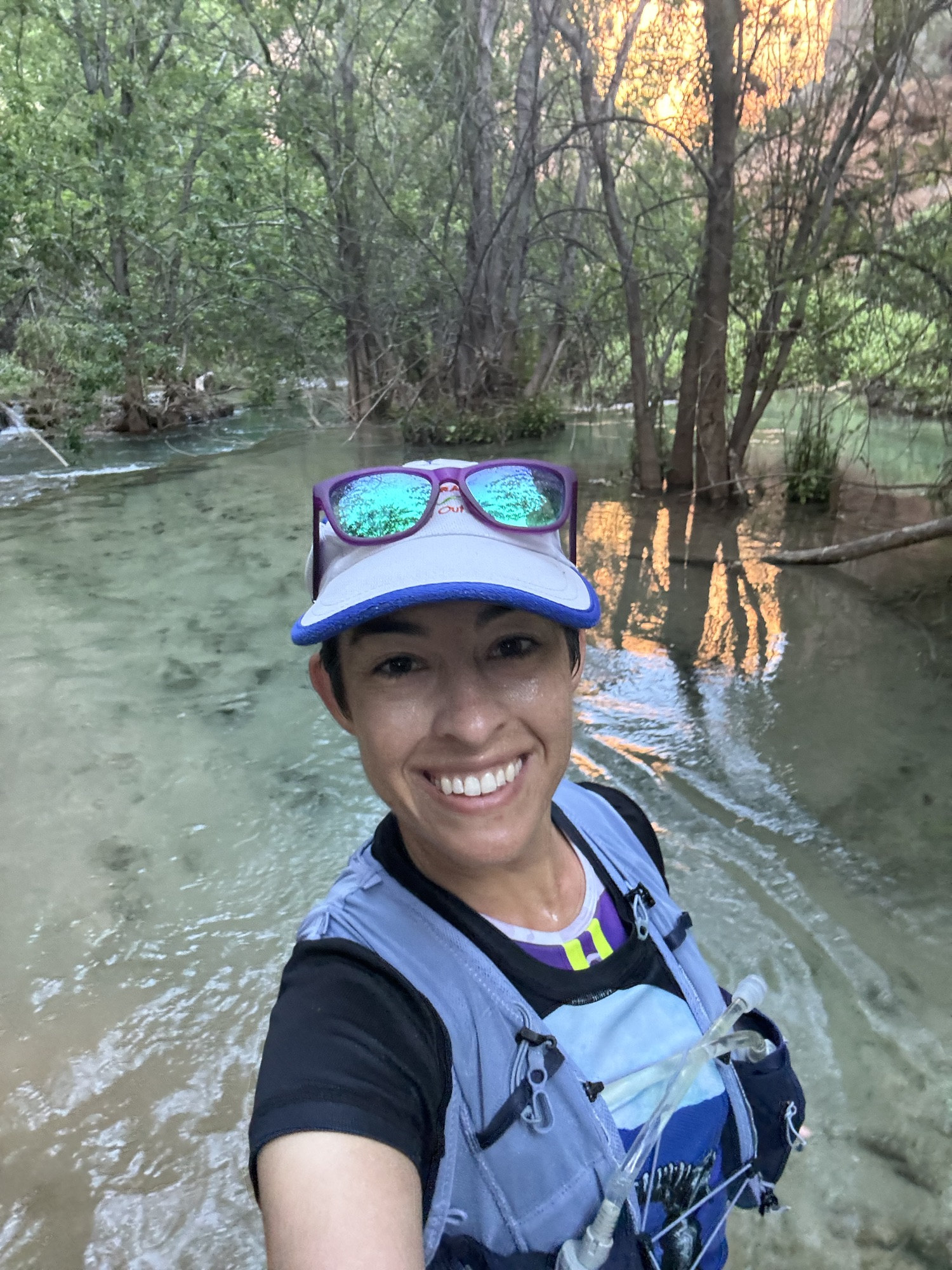
The trail itself was like 60% runnable. There were a lot of areas where I had to climb or scramble, and obviously running through a waist-deep river is tough, but many parts were runnable and the footing wasn’t terrible. I wasn’t moving fast but the views were gorgeous.
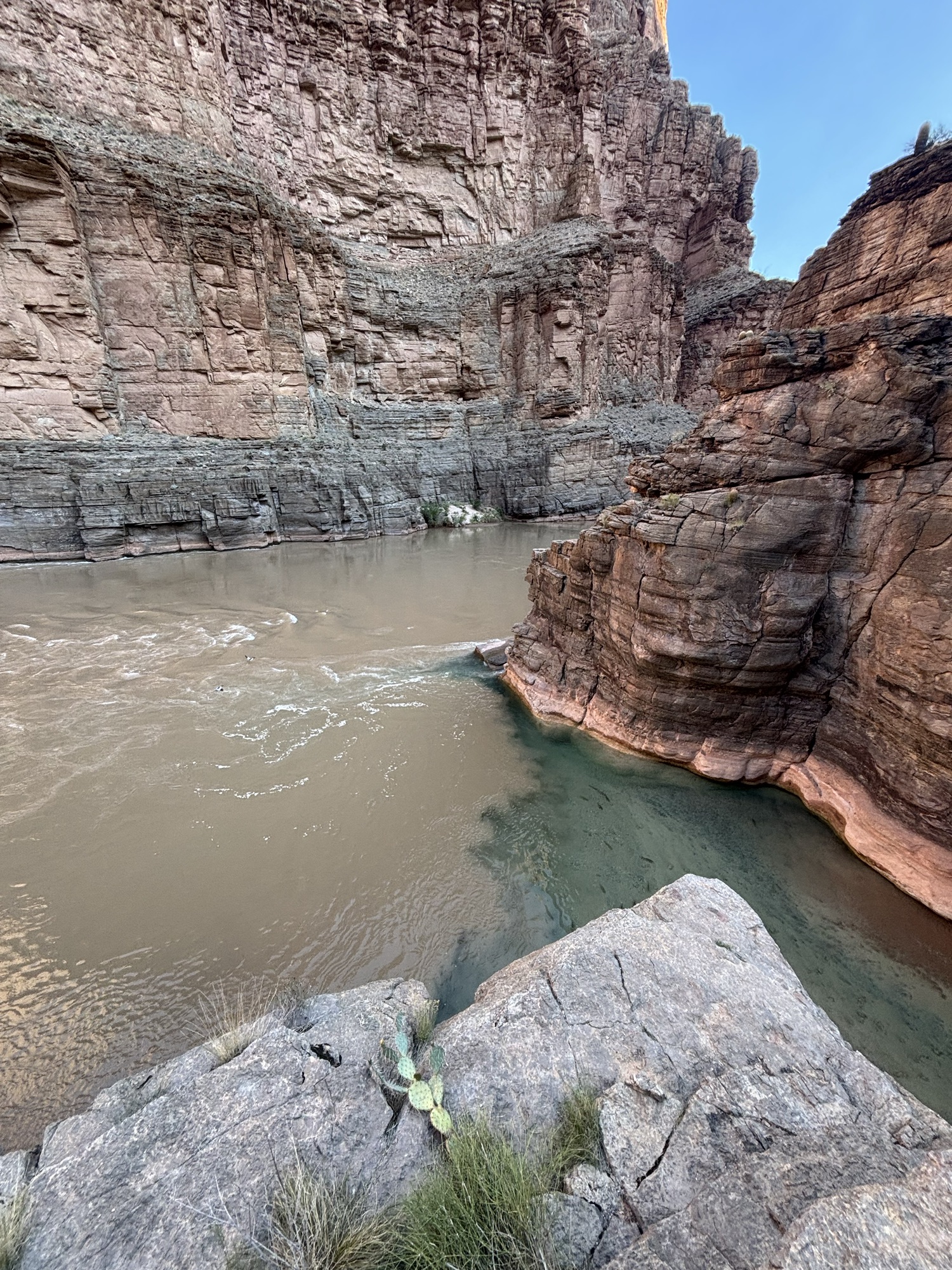
The confluence is pictured below – the left is the muddier Colorado River, and the right is Havasu Creek, which is where I came from. At that point I was in the Grand Canyon itself, which is obviously beautiful.
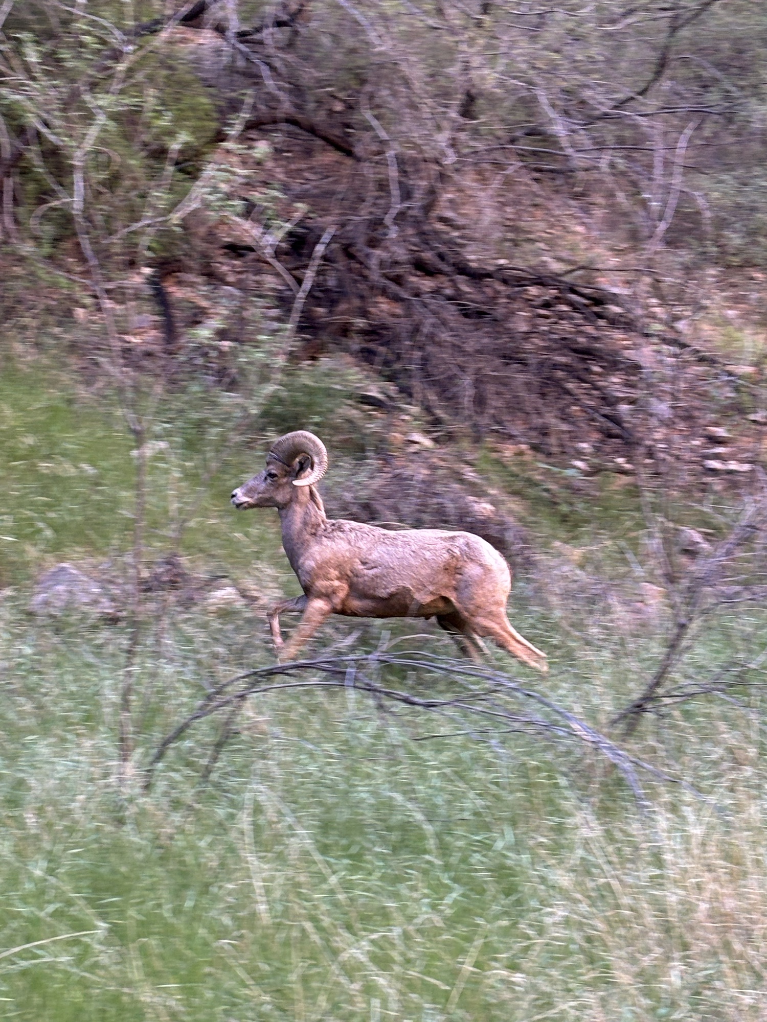
I saw so many Bighorn Sheep – about six in total. Highlight of the trip for sure. Here’s one guy who was on the trail with me.

Coming back up the canyon, I had to ascend the Death Ladder again. Because there is only one route up and down the Death Ladder, this is a bit of an exercise in patience. There is no way to signal to the folks at the top to wait a minute while you go back up, so I was able to find about two spots along the way where I could scramble up 30-40 feet, wait on a ledge for folks to pass, then go up another 30-40 feet. Other hikers are collaborative and friendly here so this wasn’t a problem at all although did take some extra time.
I stopped at Havasu Falls again to do a full immersion dunk in the water and found Mom also chilling in the pools. After that, I headed back up to Supai. Overall, a really great day of hiking and running.
In the afternoon, we got snacks and food at the cafe, then wrote some postcards. The Supai Post Office is the only one left in the US – and maybe the world – that has mail delivered by mule, so it was fun to send some friends postcards via mule.
This is what Day 2 looked like (Strava link). About 2,000 feet of climbing which isn’t bad over 21 miles.


Day 3
We left very early in the morning on Day 3 – about 4:30am. We were well-rested from the night before so we were able to leave on the earlier side.
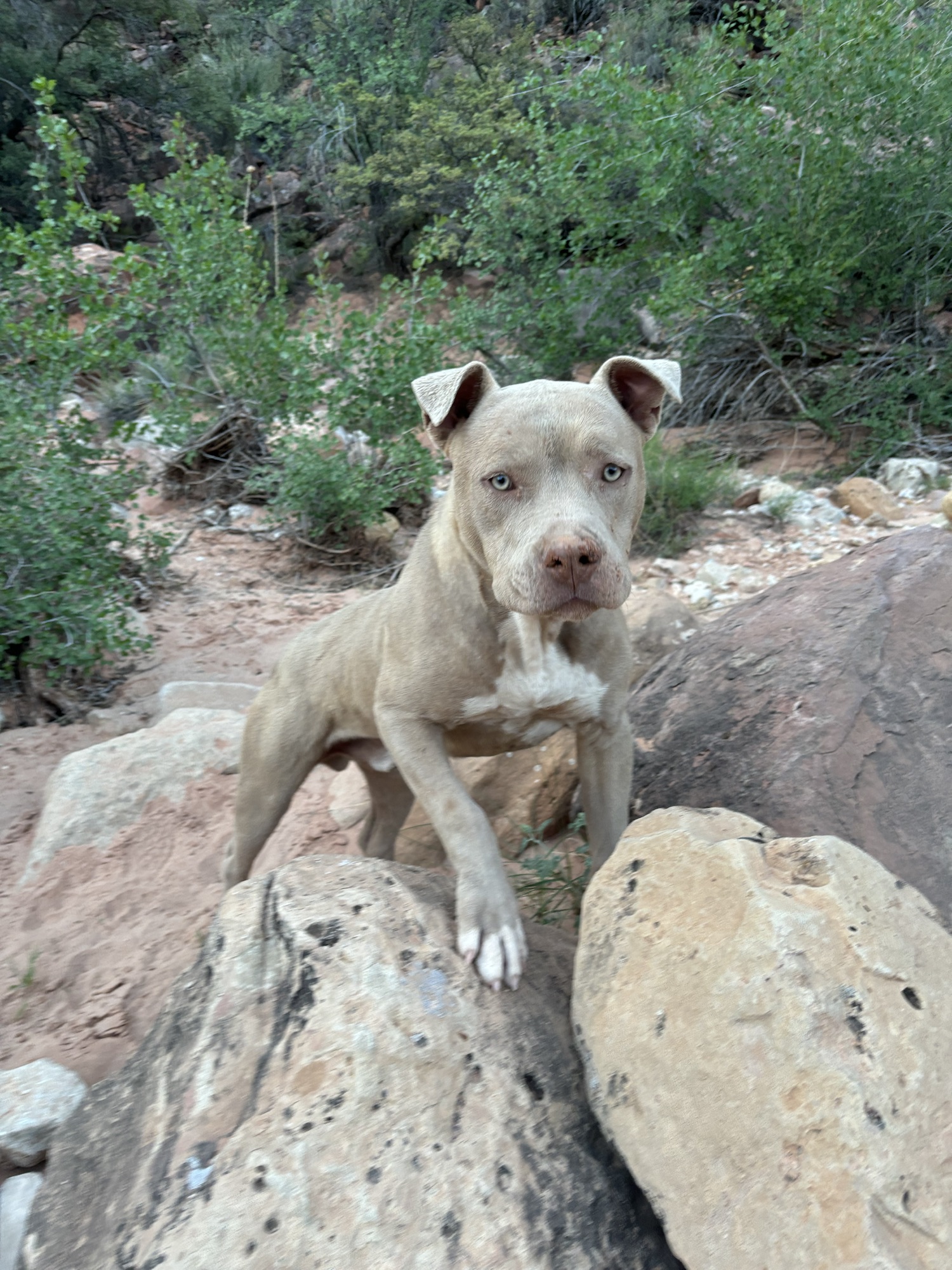
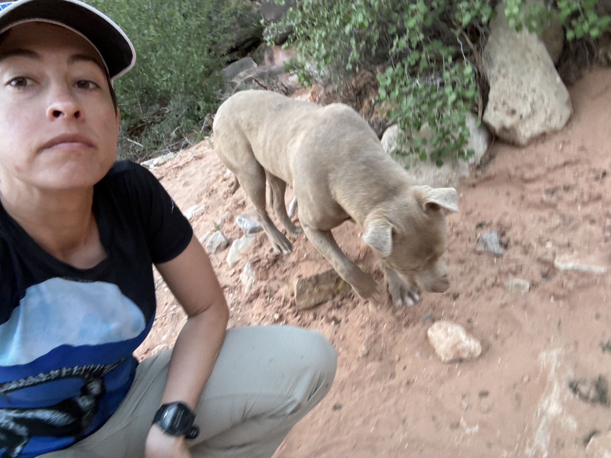
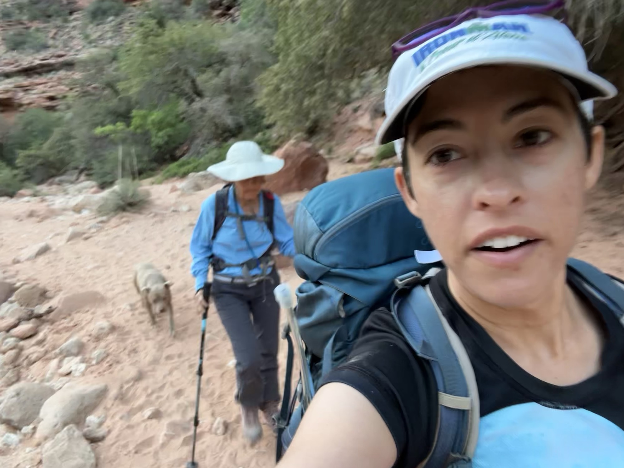
We were lucky enough to have a puppy escort us all 8 miles out of the canyon. We named him Paipai and sang songs about how good of a boy he was. He literally stayed with us the entire way and guided us through some turns. He was super cute. I went to give him water and snacks at the top, but he turned right around and found a new group of hikers to take back down the canyon, so I didn’t get a chance. We liked having him as a guide.

This is the Day 3 view (Strava link). About 1,800 feet of climbing over 8 miles with the bulk of it in the last mile. As a reminder we stayed at the Lodge, which means we only had to do 8 miles; if you are coming from the campsite, hiking back to Hilltop would be closer to 10 miles.


Overall tips and tricks
- The permitting situation is tough. Spend some time researching this and be prepared for a lot of disappointment along the way to securing your permit.
- The Havasu people are wonderful and welcoming. They operate on their own timetable, so don’t be surprised if things aren’t open exactly when the advertised hours are, or things take a bit longer than you are used to. This is their home and they are generously sharing it with us.
- The trail is well-marked and mostly runnable/hikable, except for the Death Ladder. Normal hiking/trail shoes will work. I didn’t find water shoes specifically necessary, but many people liked having them.
- Bring activities to do after you are done with your hiking/running/walking. There is not much to do down there so be self-sufficient.
- Food is not what Havasu Canyon is known for. The universe of food options are (i) the cafe (ii) a small convenience store (iii) what you bring with you. Plan accordingly.
- I found it was best to hike in and out and carry all my own stuff. There are other options: you can hire a mule to carry some of your gear in/out of the canyon, and there is a helicopter as well. These operate somewhat inefficiently, so be prepared if you choose this option. Mules are for gear only, and helicopters will transport people.
- Send some postcards! Mail by mule is highly entertaining and fun.
Reflections
Overall this was a fantastic adventure. The canyon was gorgeous and it was wonderful to spend time with my Mom. Highly recommend this iconic trek.
